Location:-
Location
between 800 and 880 east longitude and between 260
and 300 27’ north latitude, the kingdom of Nepal extends along the
south slope of the Himalayan in central Asia. Its total land area is 147,181 square
kilometers and its borders are contiguous with india in the west, south and
east with Tibetan Autonomous Region of the People’s Republic of china in the
north. Nepal’s boundary limits are as followos:

In
the east, the Mechi river and singalila range separate the country from Sikkim
to west Bengal.
In
the south, boundary pollars and about nine meters of no man’s land on either
side demarcate Nepalese territory and the Indian states of west Bengal, Bihar
and Uttar Pardesh.
In
the west, the Mahakali river is the natural border separating the kingdom from
Utter Pardesh.
In
the north the boundry markers set up in accordance with in Boundry Agreement of
1961 demarcate the border between Nepalese territory and the Tibetan Autonomous
Region of the People’s Republic of China. Nepal is a land locked country, the
nearest sea coast being 1,120 kilometers away at Calcutta in india.
iNatural Features
The Tera
In
the southern part of the country the Terai region is composed of a 26 to 32
Kilometre wide belt of fertile alluvial plain. This belt extends all the way
from the western to the eastern border, and covers about 17 percent of the
local area.


Between
In churia hills, rising abruptly to the north of the southern plains, and the
Mahabharat range, are a number of low valleys called Duns. The Duns resemble
the Terai in relief and climate and are called the inner Terai. The Churia
range runs east-west across the country and has a hogback profile with a step
south face. It averages 600 to 1220 meters in altitude and 8 to 16 kilometers
in breadth. The soil is immature and dry.
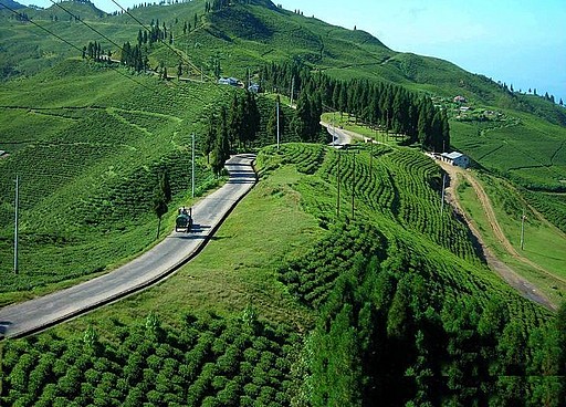
The Hills:-
The
mahabharat rangem running closely parallel to the Churia ranges, separates the
Terai from the Hill regioin. This range average 1,525 to 3,660 meters in
altitude and 16 kilometers in breadth. Its structures is synclinal and
topography is steep and jagged.
 Forests are usually found on the higher
elevations whereas the lower and gentle slopes are used for terraced
cultivation. North of this range and south of the Himalaya lies the extensively
cultivated braod hill complex of the Pahad or Hill region which covers about 64
percent of the total land area, the major area of Nepalese settlement.
Topographically rather subdued in character, the Hill region has a generally
salubrious climate.
Forests are usually found on the higher
elevations whereas the lower and gentle slopes are used for terraced
cultivation. North of this range and south of the Himalaya lies the extensively
cultivated braod hill complex of the Pahad or Hill region which covers about 64
percent of the total land area, the major area of Nepalese settlement.
Topographically rather subdued in character, the Hill region has a generally
salubrious climate.
 Braod fertile valleys including the kathmandu valley are
the areas of densest settlement in this ragion.
Braod fertile valleys including the kathmandu valley are
the areas of densest settlement in this ragion.

The Himalaya:-
The
Himalaya or’ abode of snow is the youngest and highest mountain system in the
world. It extends over 2,400 kilometres as a vast south-facing are between the
Indus and Brahmaputra river with Nanga parabat (8,125m) in the west, in india,
and Namcha Barwa (7,755m) in the east in Tibet, as it’s terminal high points.
Fully a third or 800 kilometres of it’s central section traverses Nepal and is
known as the Nepal Himalaya. Here congregate more than 250 peaks that exceed
6,000 meters in height-a unique concentration of lofty dazzling summits. Of the
thirty-one Himalayan peaks over 7,600 meters, 22 lie in the Nepal Himalaya,
including eight of the world’s 14 highest giants. These are :-
Sagarmatha
(Mt. Everest) 8,848m
Kangchenjunga 8,586m
Lhotse
8,516
ChuOyou
8201m
Dhaulagiri
8167m
Manaslu8,163
Annapurna
8,091
The
Himalayan range within Nepal is the culmination of a series of parallel ranges.
The main range lies about 90 kilometres north of the Mahabharat Lekh. The
intervening space between the two parallel ranges is made up of a lower belt of
low hills Pahad and a higher belt of elevated ridges Lekh that provide the
first intimation of the high snow peaks Himal. The main Himalayas do not from a
continuous chain, but are a series of lofty peaks or Himals in turn sends out a
maze of spurs studded with numerous peaks.
In
western and central Nepal, there is yet another mountain range that defines the
boundary between Nepal and China. The border range has elevations ranging from
5,000 to 6,000 meters with comparatively less rugged but a harsh
Climate.
Between the main Himalayan range and these border ranges lie some of the
elevated Bhot Valleys.


Much
of the high country above 5,000 meters is under snow and ice, although the
permanent snow-line varies according to aspect and gradient. Winters snowfall
occurs up to an elevation of 2,000 meters and is much heavier In the west.
While winter is harsh and bitter, summer is the season of alpine flowers, when
the high pastures teem with grazing animals form lower valleys. For the
mountain communities, it is the time for harvesting their main crops before the
winter migration to wormer climates.


The
Himalaya. The koshi river system consists of the Tamor, Arun, Dudkoshi, Likhu,
Tamakoshi and Sunkosh originate in Tibet. The confluence of these rivers is at
Tribeni (near Dharan) in Sagarmatha Zone. Flowing for almost 10 Kilometres
through a narrow gorge before entering the plains, the ‘Sapta Koshi, or ‘ seven
koshis’ as it is swollen with the waters of the seven rivers, finally merges
with the Ganges in India.
Post a Comment